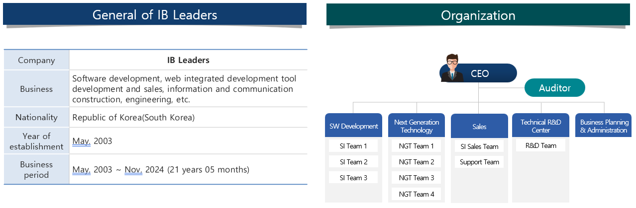
General
It consists of a technology R&D center, 2 business & sales division, a business planning & administration division and more than 80% of them are SW development experts.
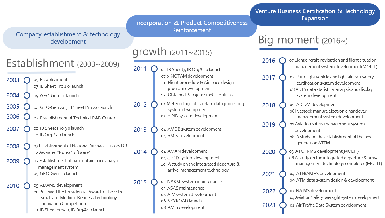
History
Starting with web development, we are creating customer value through continuous technological innovation and growth.
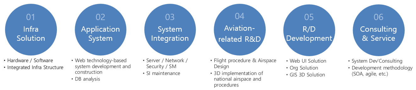
Business field
With the best technology, it is the No. 1 company in domestic aviation SI field order performance.
A-CDM (Airport Collaborative Decision Making)
It supports decision-making by sharing flight operation information among stakeholders at the airport.
- system overview
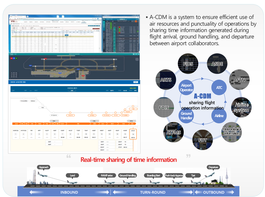
Key Features
- Real-time airport flight information
- ·Using real-time flight information of airport operators, ANSP, airlines, and ground handlers, time information for each milestone stage is collected and shared with stakeholders.
- Aircraft location information display
- ·Provide screen display by analyzing ground/airborne radar data
- ·Provide map-based aircraft location information
- Pre-departure sequence
- ·Provides automatic calculation of TTOT, TSAT time information to control tower controllers
- ·Provide timeline-based pre-departure sequence display
- Support
- ·ARTS, ASDE, ADS-B data ATM system connection support
- ·Ground moving time prediction and calculation support using machine learning technology
- * A-CDM in installation and operation at Gimpo, Gimhae, and Jeju International Airports from January 2021
ATFM Web (Air Traffic Flow Management)
Real-time information on air traffic flow management is provided on a web basis.
- system overview
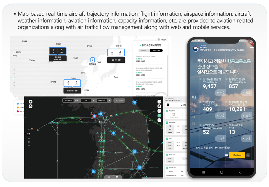
Key Features
- Air Traffic Situation Awareness Sharing
- ·Provide map-based air traffic real-time information
- ·Provides air traffic flow management issue
- CDM function
- ·Support for expanding the scope of information display for collaborative decision-making with stakeholders
- ·Emergency information sharing system support using SMS
- Air traffic information
- ·Real-time capacity analysis by control sector and display of results
- ·NOTAM and weather information display
- ·Display of flight route and time prediction information
- Airport information
- ·Display of A-CDM information
- ·Display of ramp area status information by airport
- ·Display of SID/STAR procedures for each airport
AIM System (Aeronautical Information Management)
The AIM system provides the digital aeronautical information required by ICAO's AUBS.
- system overview
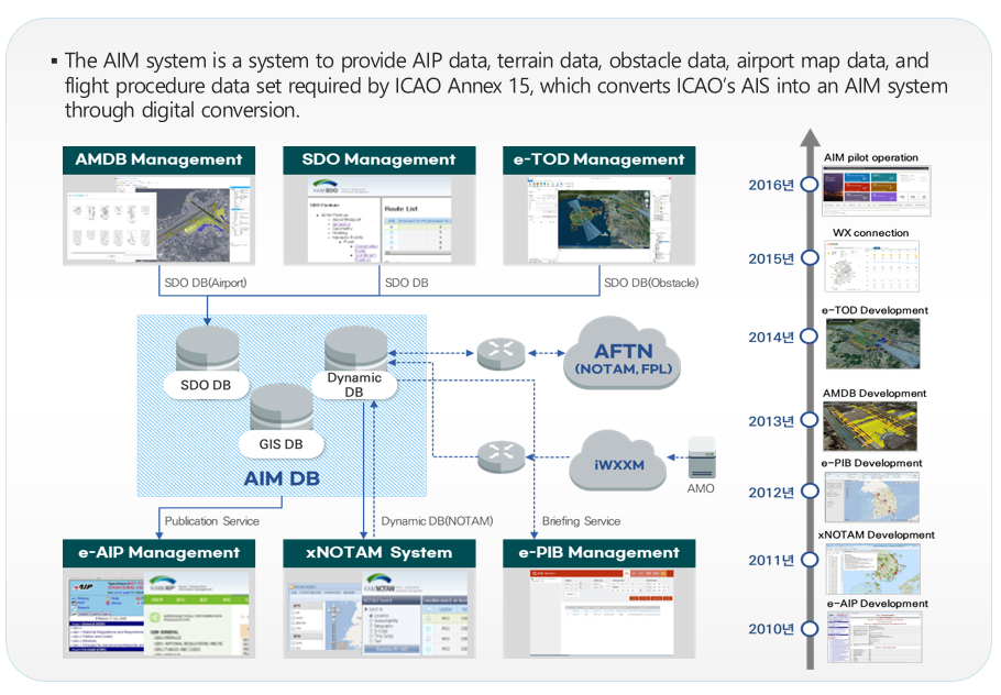
Key Features
- e-AIP
- ·Provides web-based AIP document editor function
- ·After converting HTML, provides homepage AIP publishing function
- xNOTAM
- ·Provide text NOTAM in electronic format established by ICAO
- ·Production of NOTAM, SNOWTAM, ASHTAM and AFTN publishing
- SDO M
- ·Provides the function of registering and managing static data of aviation information
- E-PIB
- ·Provides digital conversion of PIB information in text format
- AMDB & e-TOD
- ·Provide runways, taxiways, aprons etc based on AIXM
- ·Provides AIXM-based obstacle DB and 3D terrain DB
NAIMS (National Airspace Integrated Management System)
Provides web-based airspace information for the work efficiency of airspace managers and public service.
- system overview
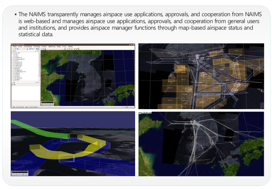
Key Features
- Airspace plan
- ·Provides application, approval, and request for NOTAM transmission for temporary airspace use
- ·Provides planning and registration functions for the use of special airspace
- Airspace information
- ·Provides basic airspace information, FIX information, and air route information registration search function.
- Airspace statistics
- ·Provides usage statistics by airspace time zone and daily
- ·Provides traffic volume statistics by air route, section, and altitude
- ·Provide fuel consumption rate information by aircraft type
- ·Provide statistics on short-distance enroutes
- ·Provides statistics on usage of training areas
SKY-ROAD
Provides web-based airspace information for the work efficiency of airspace managers and public service.
- system overview
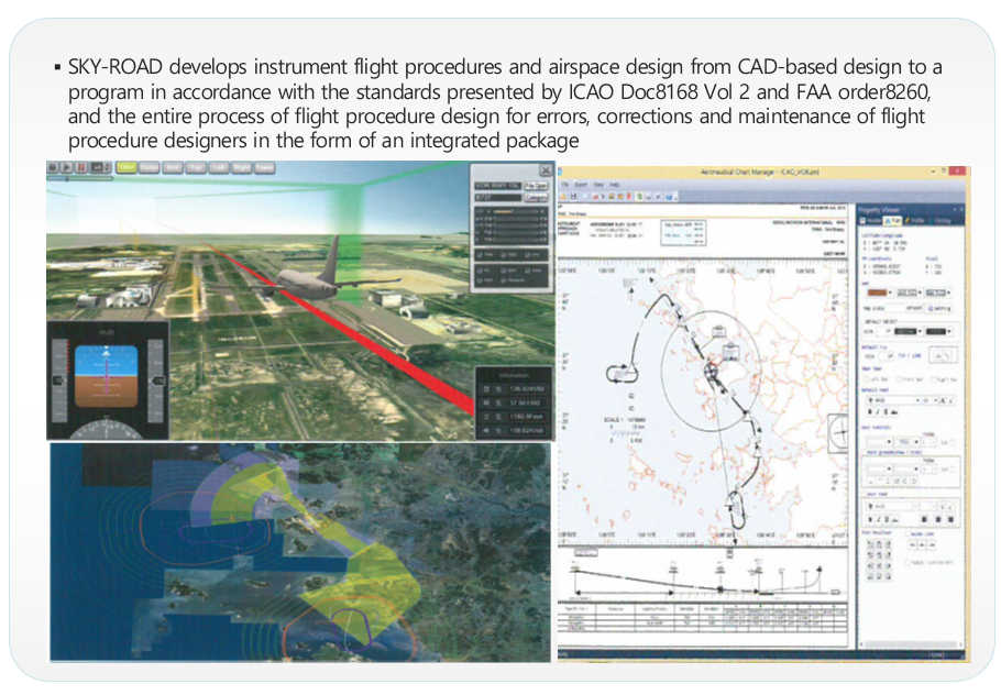
Key Features
- Flight procedure design
- ·Provides a function to reflect flight procedure design standards required by international standards
- ·Provide design function based on WGS-84 UTM coordinate system
- ·Loaded with aviation-only maps for obstacle information, minimum safe altitude setting, etc.
- ·Provides visual confirmation of obstacles and airport flight procedures
- Airspace design
- ·User provides temporary restricted area city and automatic design and correction function
- ·Provides the function of using the horizontal/vertical range of the airspace by dividing the time zone
- ·Provides a function to visually check other airspace and overlap
- 3D flight simulation
- ·Provides simulation to check the designed flight procedure
- ·Provides flight procedure display and comparative analysis function with trajectory